
Logo

Surveying Instruments

  • Home
  • Surveying Instruments
Survey Equipment • Civil Engineering • Construction

Surveying Instruments Suppliers in Hyderabad

Looking for reliable Surveying Instruments suppliers in Hyderabad? Enggific Engineering & Scientific helps customers enquire about surveying equipment for land measurement, civil engineering, construction layout, infrastructure development and geospatial applications.

Explore Total Stations, Digital Theodolites, GNSS / GPS Survey Receivers and South DGPS Systems. Contact our team to discuss your application, required accuracy, preferred model, accessories and quotation.

Surveying equipment options
Product specifications on request
Quotation enquiry support
Surveying instruments suppliers in Hyderabad

Surveying Equipment for Professional Field Applications

Surveying instruments help professionals measure angles, distances and positions to support planning, construction and mapping activities. Choosing the right instrument depends on the survey method, project requirements, working environment and required accuracy. Enggific provides an enquiry point for customers searching for surveying instruments suppliers in Hyderabad.

Applications of Surveying Instruments

  • Land and boundary surveying
  • Building layout and construction setting-out
  • Roads, highways and infrastructure projects
  • Topographic mapping and coordinate surveys
  • Control surveys and geospatial applications
  • Civil engineering and surveying education

What to Confirm Before Ordering

  • Brand, model and technical datasheet
  • Measurement accuracy and operating range
  • Supported survey and positioning methods
  • Software, data transfer and connectivity
  • Included accessories and compatible equipment
  • Warranty, calibration and service arrangements

Our Surveying Instruments Range

Explore four key surveying equipment categories. Contact Enggific to confirm current model availability, detailed specifications, pricing and suitable accessories.

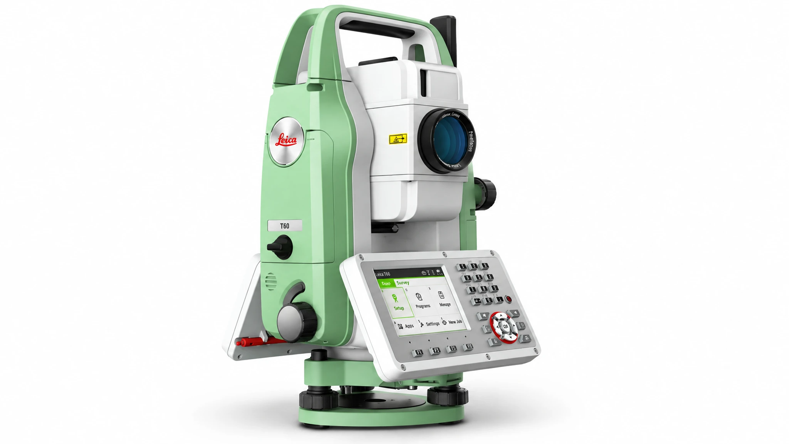
Total Station surveying instrument for land measurement and construction layout

Total Station

A Total Station is an electronic surveying instrument used to measure horizontal angles, vertical angles and distances. Depending on the model and workflow, it can support coordinate collection, topographic surveys, construction setting-out and site layout.

Instrument type Electronic / optical Total Station
Measurement functions Angles and distances
Angle accuracy Varies by model; confirm datasheet
Distance measurement EDM; range depends on model and target
Data handling Storage and transfer options vary
Applications Land surveys, layout and topographic work
Enquire About Total Station
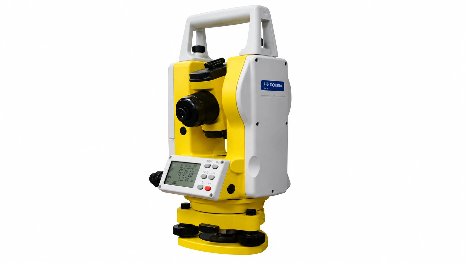
Digital Theodolite for horizontal and vertical angle measurement in surveying

Digital Theodolite

A Digital Theodolite measures horizontal and vertical angles for alignment, traversing, construction layout and other engineering survey tasks. Its electronic display helps users read measured angles according to the instrument's resolution and specifications.

Instrument type Electronic / Digital Theodolite
Measurement functions Horizontal and vertical angles
Angle accuracy Model-dependent; confirm datasheet
Display Digital readout
Power supply Battery type varies by model
Applications Alignment, traversing and setting-out
Enquire About Digital Theodolite
GNSS GPS survey receiver for satellite positioning and geospatial surveying

GNSS / GPS Survey Receiver

GNSS / GPS Survey Receivers use satellite positioning to support coordinate collection, land surveys, mapping and geospatial fieldwork. Receiver capabilities and achievable accuracy depend on the supported satellite systems, correction method, site conditions and selected configuration.

Instrument type GNSS / GPS survey receiver
Primary function Satellite-based positioning
Satellite support Varies by receiver model
Positioning modes Configuration and correction dependent
Connectivity Model-dependent communication options
Applications Land surveys, mapping and geospatial work
Enquire About GNSS / GPS
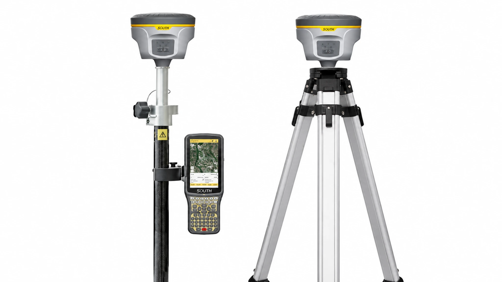
South DGPS surveying system for differential GNSS positioning and precision surveying

South DGPS System

A South DGPS surveying system is a product category to enquire about for differential GNSS positioning and survey workflows. Depending on the exact model and configuration, the system may support static, RTK or other positioning workflows. Confirm supported functions and specifications against the manufacturer's datasheet.

Product category South DGPS / GNSS survey system
Positioning method Model and configuration dependent
GNSS support Confirm supported satellite systems
Correction workflow Confirm supported correction methods
Connectivity Confirm radio, network and controller options
Applications Surveying, mapping and coordinate collection
Enquire About South DGPS

Specifications above describe general product categories, not guaranteed specifications of a particular model. Confirm the model number, manufacturer datasheet, configuration, included accessories, availability and commercial terms before ordering.

How to Choose the Right Surveying Instrument

When comparing surveying instruments suppliers in Hyderabad, consider your field requirements and verify the instrument's technical specifications before purchase.

Select by Application

  • Total Station: for angle and distance measurements, coordinates and construction setting-out.
  • Digital Theodolite: for horizontal and vertical angle measurement and alignment work.
  • GNSS / GPS Receiver: for satellite-based positioning, mapping and coordinate collection.
  • South DGPS System: enquire about the appropriate model and supported differential positioning workflow.

Technical Details to Compare

  • Required accuracy and measurement range
  • Supported measurement and positioning modes
  • Data collection, software and file compatibility
  • Connectivity and field controller requirements
  • Included accessories, battery and charging equipment
  • Warranty, calibration and service arrangements

Surveying Instruments for Civil Engineering and Infrastructure

Surveying equipment supports a range of measurement and positioning tasks. Select an instrument based on the required workflow and the manufacturer's technical specifications.

Construction & Infrastructure

Equipment for building layout, construction setting-out, alignment, coordinate measurements and infrastructure survey work.

Land Surveying & Mapping

Instrument options for boundary surveys, coordinate collection, topographic mapping and other land measurement applications.

Engineering & Survey Consultants

Compare measurement, angle and satellite-positioning equipment according to project methods, accuracy requirements and site conditions.

Educational Institutions

Surveying instrument options for civil engineering practicals, demonstrations and surveying laboratory requirements.

How to Enquire for Surveying Instruments in Hyderabad

Share the following information to help identify the appropriate instrument and request a quotation.

1

Share Requirements

Tell us the product category, application, quantity and preferred brand.

2

Confirm Specifications

Discuss model details, accuracy, supported functions and accessories.

3

Request a Quotation

Ask for current pricing, availability, delivery terms and warranty information.

4

Review the Offer

Verify the model, datasheet, package contents and commercial terms before ordering.

Frequently Asked Questions About Surveying Instruments

Answers to common questions about surveying equipment, product selection, specifications and enquiries in Hyderabad.

1. Where can I find surveying instruments suppliers in Hyderabad?

Enggific Engineering & Scientific is located at Gunfoundry, Abid Road, Hyderabad. Contact the team to enquire about Total Stations, Digital Theodolites, GNSS / GPS Survey Receivers and South DGPS Systems. Confirm product availability and details before visiting or placing an order.

2. Which surveying instruments can I enquire about at Enggific?

You can enquire about four main categories on this page: Total Stations, Digital Theodolites, GNSS / GPS Survey Receivers and South DGPS Systems. Contact Enggific to confirm the current models, specifications and availability.

3. What is a Total Station used for?

A Total Station measures horizontal and vertical angles and distances. Depending on the model and workflow, it can be used for land surveying, coordinate measurement, topographic work and construction setting-out.

4. What is a Digital Theodolite used for?

A Digital Theodolite is used to measure horizontal and vertical angles. It supports surveying tasks such as alignment, traversing and construction layout. The available angle accuracy and features depend on the selected model.

5. What is the difference between GNSS and GPS surveying equipment?

GPS is one satellite navigation system, while GNSS refers to satellite navigation systems more broadly. A GNSS receiver may support multiple satellite constellations, depending on its design. Confirm the supported systems and positioning modes in the receiver datasheet.

6. What is a South DGPS System used for?

A South DGPS system is a surveying equipment category associated with differential GNSS positioning workflows. Supported functions, positioning methods and achievable accuracy depend on the exact model, configuration, correction source and operating conditions.

7. How do I choose the right surveying instrument?

Identify your application, required accuracy, measurement range, site conditions and data collection needs. Compare the instrument's datasheet, compatible software and accessories, warranty and service arrangements before requesting a quotation.

8. Can I request surveying instrument prices on WhatsApp?

Yes. Use the WhatsApp enquiry buttons on this page to share the product category, preferred brand or model, quantity and application. Ask the Enggific team to confirm current pricing and availability.

9. What should I check before purchasing a Total Station or DGPS system?

Confirm the exact model, technical datasheet, accuracy, supported functions, connectivity, software compatibility, included accessories, warranty, calibration requirements and service arrangements.

10. Does the product price include accessories and warranty?

Package contents and warranty terms depend on the specific instrument and quotation. Ask the supplier to confirm included accessories, batteries, chargers, controllers, carrying cases, warranty coverage and applicable service conditions in writing.

Looking for Surveying Instruments Suppliers in Hyderabad?

Contact Enggific Engineering & Scientific for enquiries about Total Stations, Digital Theodolites, GNSS / GPS Survey Receivers and South DGPS Systems. Share your project requirements to request model details and a quotation.

Enggific Engineering & Scientific

Phone:
+91 90005 27231

WhatsApp:
Chat with our team

Address:
Ground Floor, A-11, Kushal Shopping Mayur Complex,
Gunfoundry, Abid Road, Hyderabad – 500001,
Telangana, India.